Catchment
From REFORM wiki
Revision as of 13:22, 20 May 2014 by R.c.grabowski (Talk | contribs)
Catchment
Definition
A catchment is an area of land that is drained by a river and its tributaries. Delineation can be made based on the topographic divide (watershed) using digital terrain models (DTM) and a Geographic Information System (GIS). DTMs are freely available online from a variety of sources, such as the 30 m resolution ASTER GDEM from NASA and Japan Space Systems (http://asterweb.jpl.nasa.gov/gdem.asp).
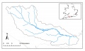
The River Frome catchment is a medium-sized, lowland, calcareous catchment located in southern England.
