File list
This special page shows all uploaded files.
| Date | Name | Thumbnail | User | Description | Versions | |
|---|---|---|---|---|---|---|
| 10:14, 13 May 2014 | Table 3.jpg (file) | 18 KB | Bs3na | Table 2. Structure of table to undertake options analysis | 1 | |
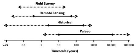
| 10:45, 23 May 2014 | TimescalesApproaches.jpg (file) |  |
18 KB | R.c.grabowski | 1 | |
| 14:44, 10 June 2015 | K result mp.jpg (file) |  |
18 KB | Jochem | 1 | |
| 11:33, 12 February 2014 | V table1.jpg (file) | 19 KB | Benjamin Kupilas | 1 | ||
| 15:42, 1 August 2011 | CASS - Project map.jpg (file) |  |
19 KB | Avarello | 1 | |
| 14:03, 10 June 2015 | V result mp.jpg (file) |  |
19 KB | Jochem | 1 | |
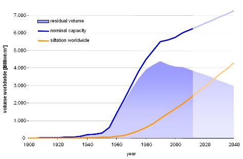
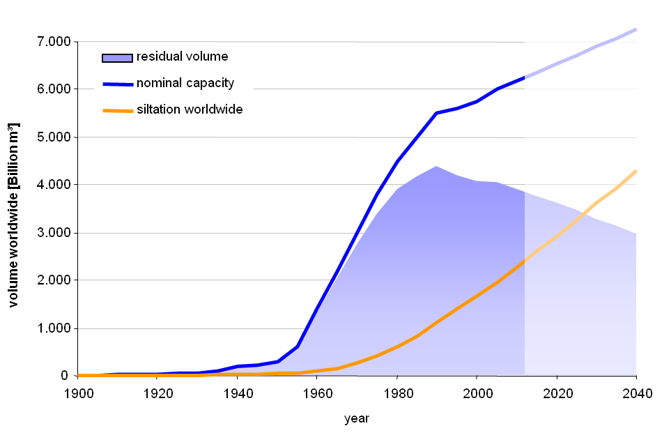
| 18:04, 19 March 2013 | Worldwide Reservoir Siltation small.png (file) |  |
19 KB | Michael | 1 | |
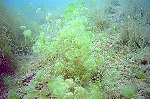
| 18:17, 13 April 2010 | Macrophytes.jpg (file) |  |
19 KB | Admin | 1 | |
| 15:32, 14 June 2010 | Deva1.jpg (file) |  |
20 KB | Dgjalon | 1 | |
| 19:30, 17 May 2010 | Zujar3.JPG (file) |  |
20 KB | Dgjalon | 1 | |
| 15:33, 14 June 2010 | Deva2.jpg (file) |  |
20 KB | Dgjalon | 1 | |
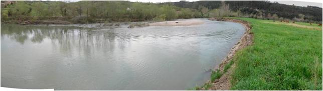
| 16:56, 14 June 2010 | Nansa1.jpg (file) |  |
20 KB | Dgjalon | 1 | |
| 10:17, 4 June 2009 | Manual of operation of the web-based tool.pdf (file) | 20 KB | Morales | 1 | ||
| 16:56, 14 June 2010 | Nansa2.jpg (file) |  |
21 KB | Dgjalon | 1 | |
| 18:07, 14 June 2010 | Cadagua3.jpg (file) |  |
21 KB | Dgjalon | 1 | |
| 17:44, 4 November 2015 | REFORM Tool box logical framework approach.pdf (file) | 21 KB | Gertjan | 1 | ||
| 13:31, 30 July 2013 | Cole measures.JPG (file) |  |
21 KB | Saskia.deltares | Map of the Cole project site | 1 |
| 17:07, 3 September 2010 | Wing deflectors .jpg (file) |  |
21 KB | Dgjalon | 1 | |
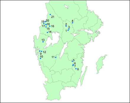
| 13:43, 7 July 2011 | FPMSWE SiteLocations.jpg (file) |  |
21 KB | Avarello | 1 | |
| 18:21, 9 April 2010 | Odra2.jpg (file) |  |
21 KB | Dgjalon | Absence of riparian corridor. Previous the restoration project | 1 |
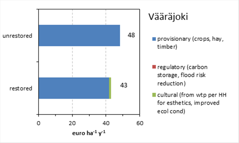
| 08:06, 5 May 2014 | ES vaarajoki economic value.png (file) |  |
22 KB | Gertjan | Total economic value as estimated with the REFORM ecosystem services accumulation approach for the Vääräjoki (FIN). Data based on thesiswork of Maarten Plug. | 1 |
| 17:53, 18 July 2011 | Rheinauen Karlsruhe -Costs.jpg (file) |  |
22 KB | Avarello | 1 | |
| 18:43, 23 March 2010 | Example.jpg (file) |  |
22 KB | Admin | 1 | |
| 18:45, 23 March 2010 | DelftCluster.jpg (file) |  |
22 KB | Admin | 1 | |
| 18:29, 23 March 2010 | Delft-Cluster.jpg (file) |  |
22 KB | Admin | 1 | |
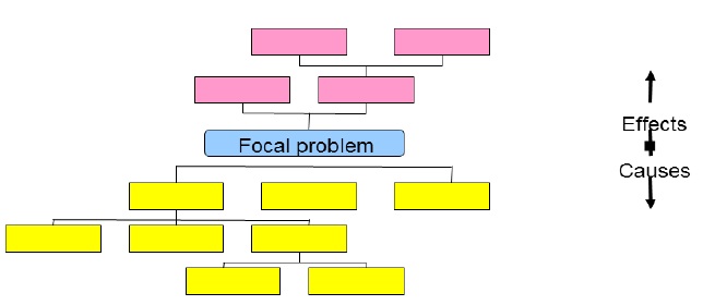
| 18:15, 12 May 2014 | Figure 3.jpg (file) |  |
23 KB | Bs3na | Figure 3: Structure of problem analysis tree | 1 |
| 17:36, 4 November 2015 | REFORM Tool box monitoring design.pdf (file) | 24 KB | Gertjan | 1 | ||
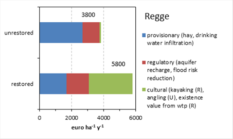
| 08:05, 5 May 2014 | ES Regge economic value.png (file) |  |
24 KB | Gertjan | Total economic value as estimated with the REFORM ecosystem services accumulation approach for the Regge (NL). Data based on thesiswork of Tim Brockhoff. | 1 |
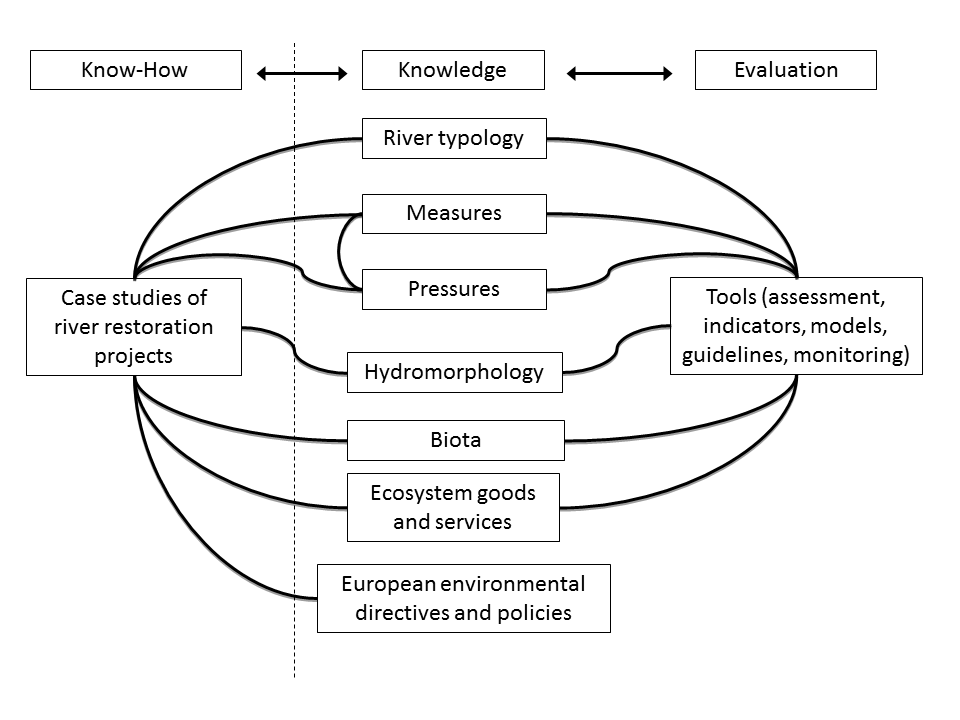
| 16:11, 6 May 2014 | REFORM wiki base structure.png (file) |  |
25 KB | Gertjan | Basic structure of the links in the REFORM wiki | 1 |
| 17:00, 8 April 2010 | Anson2.jpg (file) |  |
25 KB | Dgjalon | Ansón river near the town of Ramales | 1 |
| 15:33, 14 June 2010 | Deva3.jpg (file) |  |
25 KB | Dgjalon | 1 | |
| 17:39, 4 November 2015 | REFORM Tool box setting SMART objectives.pdf (file) | 25 KB | Gertjan | 1 | ||
| 14:35, 31 January 2013 | EUmethodsSum clip.png (file) |  |
26 KB | Bbelletti | 1 | |
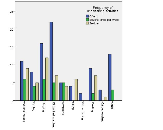
| 11:39, 12 February 2014 | V picture4.jpg (file) |  |
26 KB | Benjamin Kupilas | Figure 2: Frequency of common resident activities near Vääräjoki. | 1 |
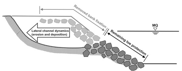
| 15:47, 23 November 2010 | BankRemoval.jpg (file) |  |
27 KB | IGBBerlin | 1 | |
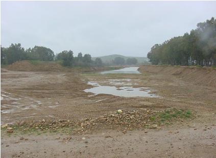
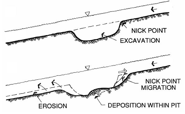
| 10:57, 14 October 2010 | GravelMining2.jpg (file) |  |
27 KB | IGBBerlin | 1 | |
| 18:01, 19 March 2013 | Worldwide Reservoir Siltation.png (file) |  |
27 KB | Michael | 1 | |
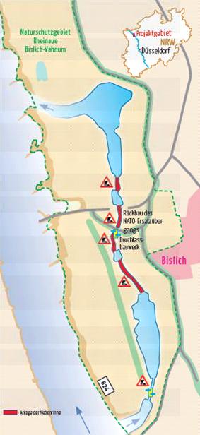
| 09:24, 7 August 2013 | Map bislich.JPG (file) |  |
27 KB | Saskia.deltares | Map of planned measures in Bislich-Vahnum. Taken from NABU-Naturschutzstation e.V., Nebenstromrinne am Niederrhein | 1 |
| 09:22, 24 June 2010 | Type5.jpg (file) |  |
27 KB | Mtudor | 1 | |
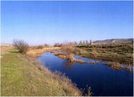
| 15:47, 10 June 2015 | Skern RestoredSection.jpg (file) |  |
27 KB | Jochem | 1 | |
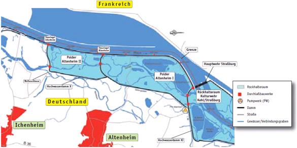
| 20:29, 6 August 2013 | Map polder altenheim.JPG (file) |  |
27 KB | Saskia.deltares | Map of the project Polder Altenheim. Taken from Siepe, A. (2006) | 1 |
| 10:28, 19 July 2011 | SDF-Public participation.jpg (file) |  |
28 KB | Avarello | 1 | |
| 17:21, 20 May 2010 | Aragon Estajado.jpg (file) |  |
28 KB | Otal | Artificial pond created in the Estajado area | 1 |
| 16:05, 18 May 2010 | Chicamo3.jpg (file) |  |
28 KB | Dgjalon | 1 | |
| 18:20, 9 April 2010 | Odra1.jpg (file) |  |
29 KB | Dgjalon | Loss of lateral functionality due to bank elevation. Previous the restoration project | 1 |
| 16:27, 19 May 2010 | Chicamo2.jpg (file) |  |
29 KB | Dgjalon | 2 | |
| 09:12, 24 June 2010 | Type2.jpg (file) |  |
29 KB | Mtudor | 1 | |
| 12:16, 15 June 2010 | Logo cnrs.jpeg (file) |  |
30 KB | Admin | Provided by Herve Piegay | 1 |
| 18:50, 2 September 2010 | Regulacion4.jpg (file) |  |
31 KB | Dgjalon | 1 | |
| 20:54, 19 May 2010 | Vallacuera pond.JPG (file) |  |
31 KB | Otal | New pond created in the mouth of Vallacuera ravine | 1 |
First page |
Previous page |
Next page |
Last page |