File list
This special page shows all uploaded files.
| Name | Thumbnail | Size | User | Description | Versions | |
|---|---|---|---|---|---|---|
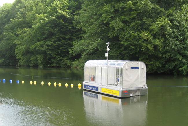
| 17:12, 19 March 2013 | V 101 Agger.jpg (file) |  |
45 KB | Michael | SediMover P101 | 1 |
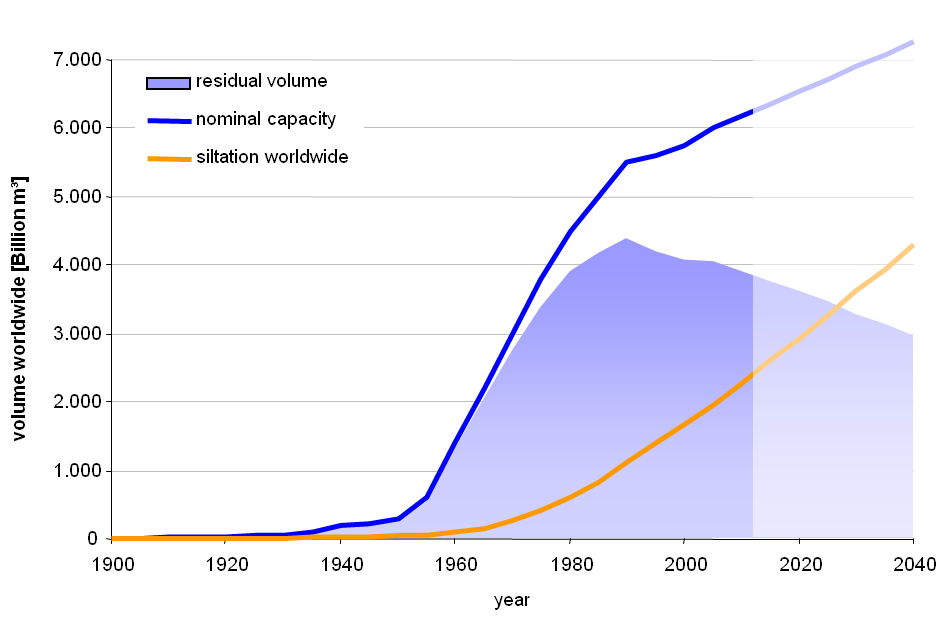
| 18:01, 19 March 2013 | Worldwide Reservoir Siltation.png (file) |  |
27 KB | Michael | 1 | |
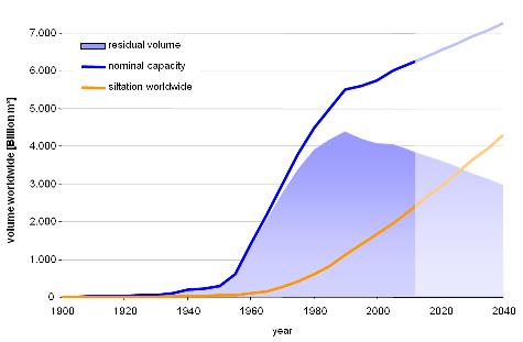
| 18:04, 19 March 2013 | Worldwide Reservoir Siltation small.png (file) |  |
19 KB | Michael | 1 | |
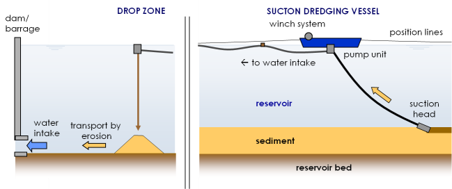
| 18:20, 19 March 2013 | Sediment transfer scheme small.png (file) |  |
33 KB | Michael | 1 | |
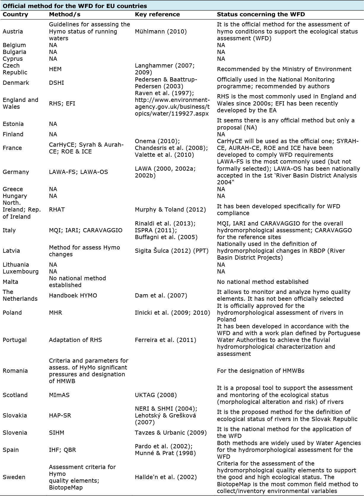
| 17:26, 15 April 2013 | WFD2.png (file) |  |
210 KB | Bbelletti | 1 | |
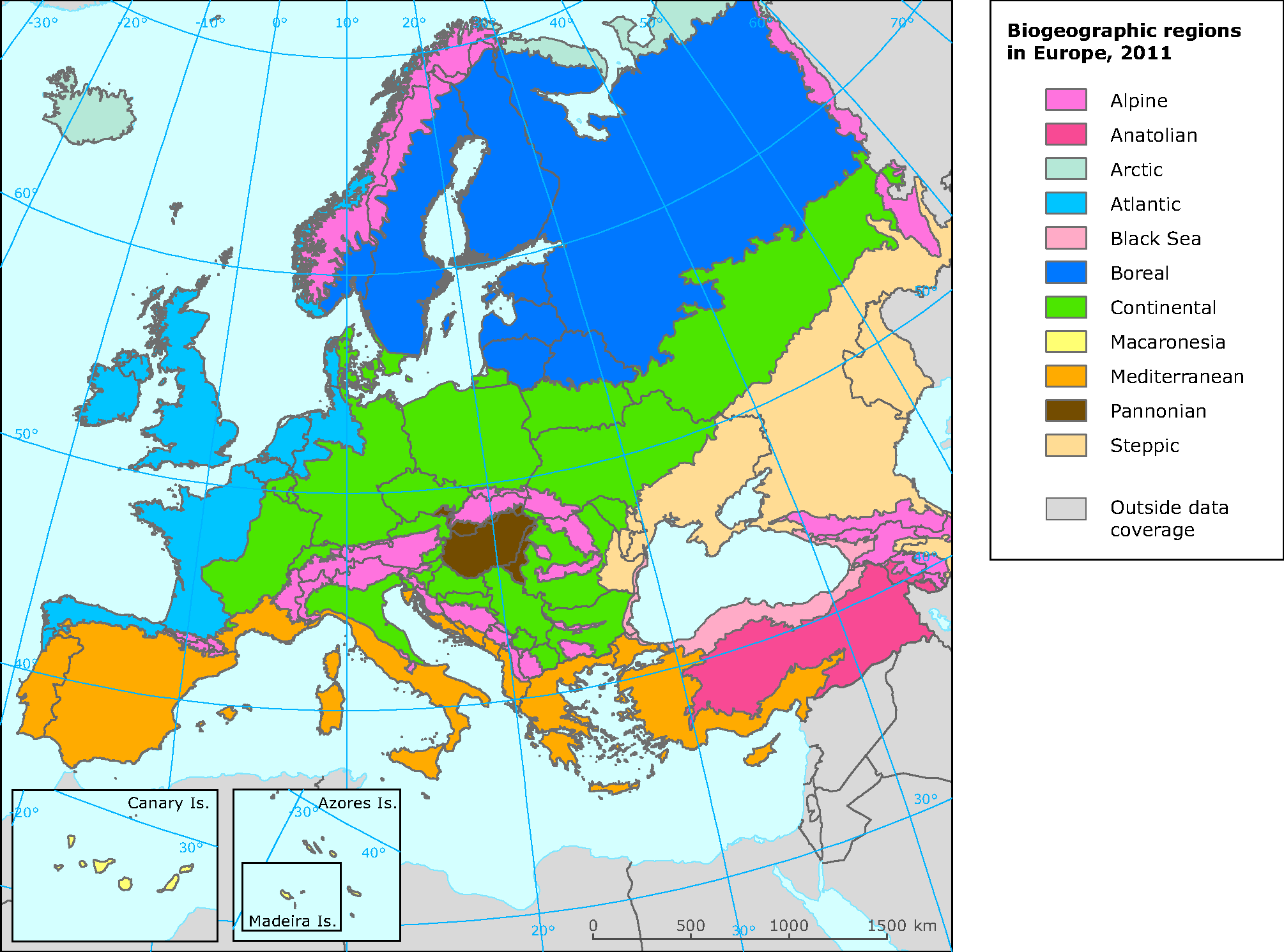
| 10:16, 14 June 2013 | Biogeographic areas.png (file) |  |
159 KB | R.c.grabowski | European Biogeographic areas. Copyright European Environment Agency 2012 | 1 |
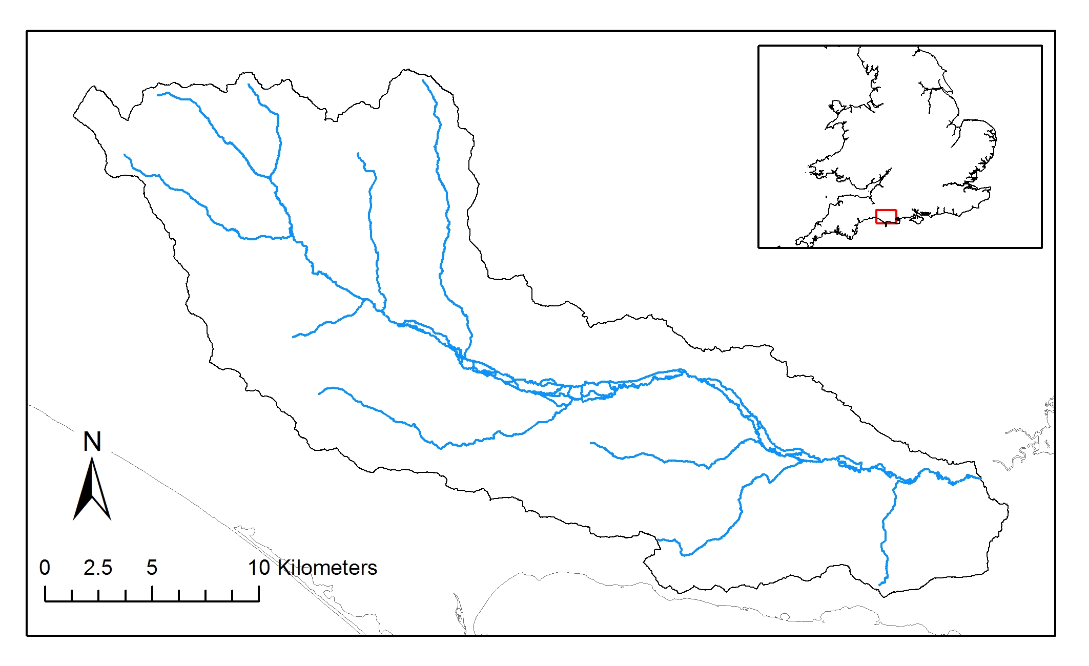
| 10:17, 14 June 2013 | Catchment3.jpg (file) |  |
458 KB | R.c.grabowski | River Frome catchment - For hierarchical framework. | 1 |
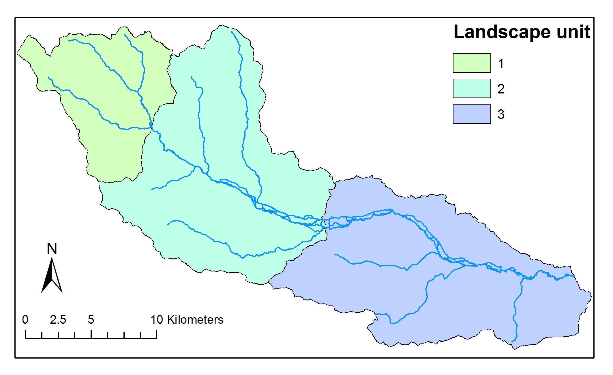
| 10:18, 14 June 2013 | Landscapeunit3.jpg (file) |  |
461 KB | R.c.grabowski | River Frome Landscape units - for hierarchical framework | 1 |
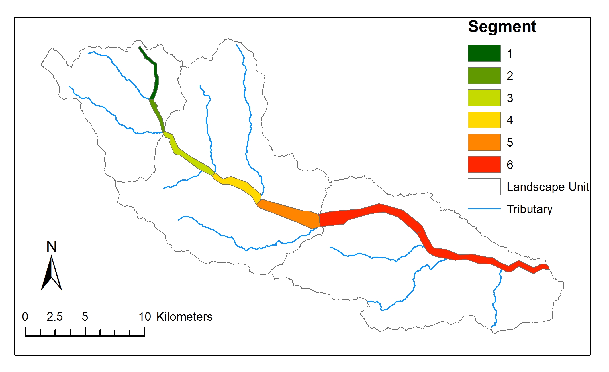
| 10:18, 14 June 2013 | Frome segment deline.jpg (file) |  |
404 KB | R.c.grabowski | River Frome Segments - for hierarchical framework | 1 |
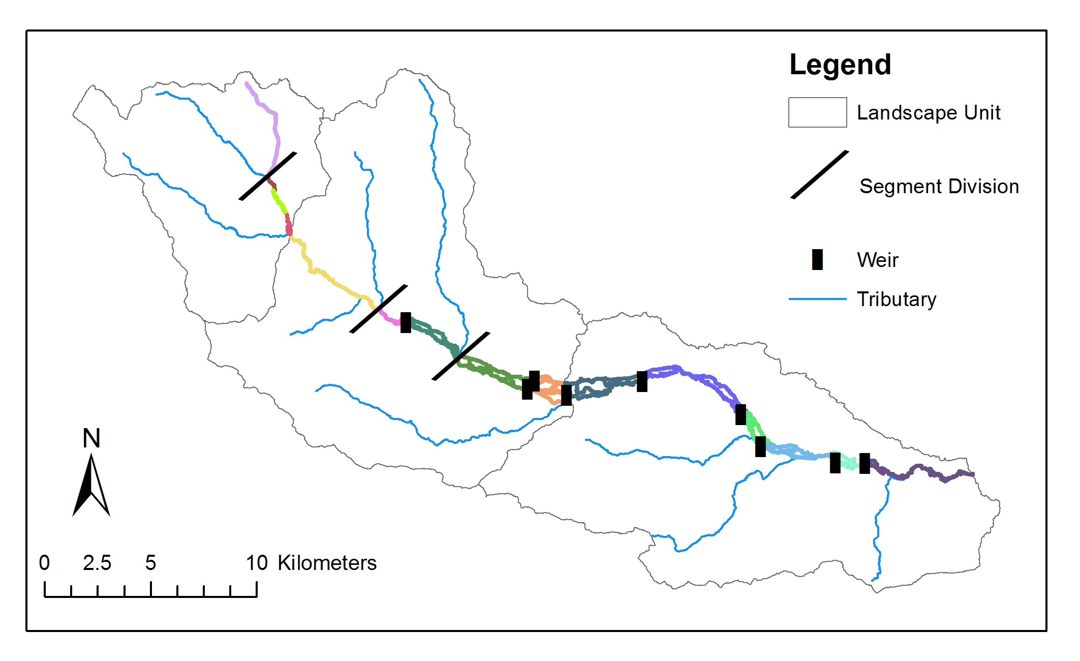
| 10:19, 14 June 2013 | Frome reach deline.jpg (file) |  |
425 KB | R.c.grabowski | River Frome reaches - for hierarchical framework | 1 |
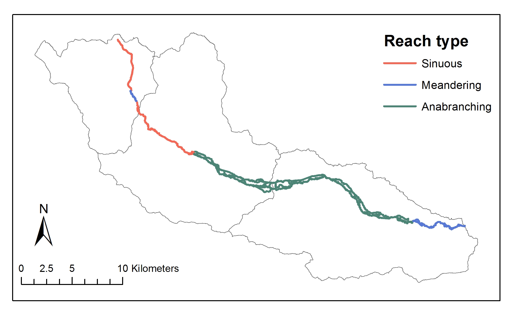
| 11:08, 14 June 2013 | Frome reach type.jpg (file) |  |
320 KB | R.c.grabowski | For hierarchical framework | 1 |
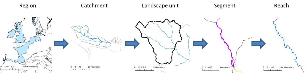
| 16:09, 14 June 2013 | Delineation diagram.jpg (file) | 37 KB | R.c.grabowski | 1 | ||
| 17:31, 20 June 2013 | HierarchicalFramework.pdf (file) | 100 KB | R.c.grabowski | Draft Section 3 of Deliverable WP2.1 | 1 | |
| 17:31, 20 June 2013 | Delineation.pdf (file) | 362 KB | R.c.grabowski | Draft Section 4 of Deliverable WP2.1 | 1 | |
| 17:32, 20 June 2013 | Characterisation.pdf (file) | 1.68 MB | R.c.grabowski | Draft Section 5 of Deliverable WP2.1 | 1 | |
| 17:32, 20 June 2013 | Typology.pdf (file) | 171 KB | R.c.grabowski | Draft Section 6 of Deliverable WP2.1 | 1 | |
| 17:33, 20 June 2013 | 4 Indicators.pdf (file) | 12 KB | R.c.grabowski | Draft Section 7 of Deliverable WP2.1 | 1 | |
| 17:43, 20 June 2013 | Typology1.jpg (file) |  |
46 KB | R.c.grabowski | 1 | |
| 17:43, 20 June 2013 | Typology2.jpg (file) |  |
67 KB | R.c.grabowski | 1 | |
| 13:31, 30 July 2013 | Cole measures.JPG (file) |  |
21 KB | Saskia.deltares | Map of the Cole project site | 1 |
| 13:50, 30 July 2013 | Skerne map.JPG (file) |  |
38 KB | Saskia.deltares | Map of measures Skerne | 1 |
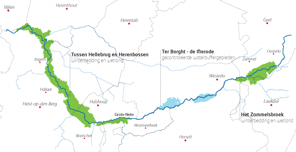
| 12:22, 1 August 2013 | Vallei-van-de-grote-netekleur.png (file) |  |
252 KB | Saskia.deltares | Project area Grote Nete taken from www.sigmaplan.be | 1 |
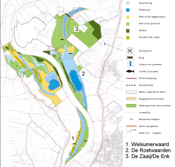
| 12:52, 1 August 2013 | Map IJsseluiterwaarden Olst.JPG (file) |  |
57 KB | Saskia.deltares | map of IJsseluiterwaarden Olst taken from the EIA (see source in reference list) | 1 |
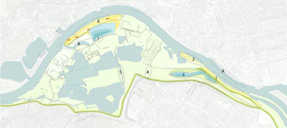
| 11:15, 2 August 2013 | Map Meinerswijk.JPG (file) |  |
47 KB | Saskia.deltares | Map of Meinerswijk project taken from Gebiedsvisie (see 2nd reference in reference list) | 1 |
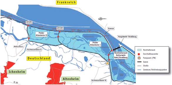
| 20:29, 6 August 2013 | Map polder altenheim.JPG (file) |  |
27 KB | Saskia.deltares | Map of the project Polder Altenheim. Taken from Siepe, A. (2006) | 1 |
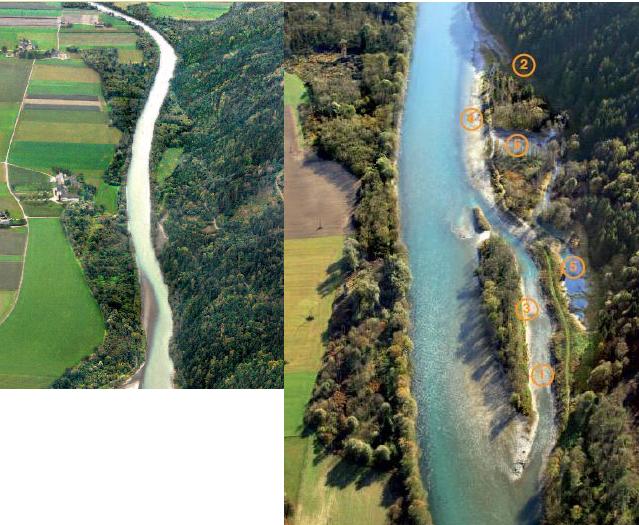
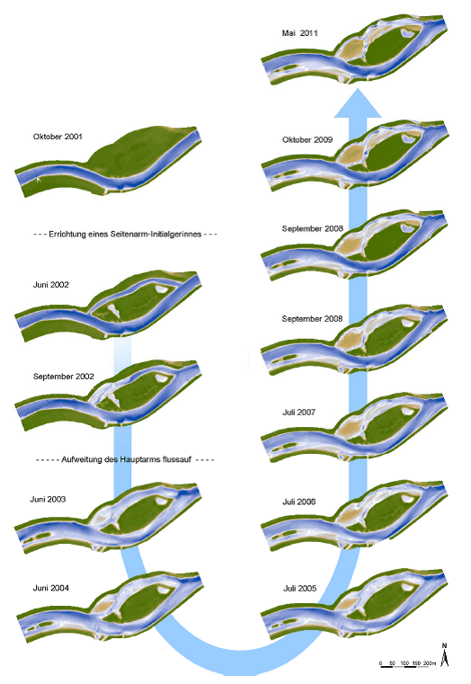
| 21:59, 6 August 2013 | Rosenheim before after.JPG (file) |  |
74 KB | Saskia.deltares | Rosenheim before and after the construction of the measures. Modified from Life vein – Upper Drau River (2011) | 1 |
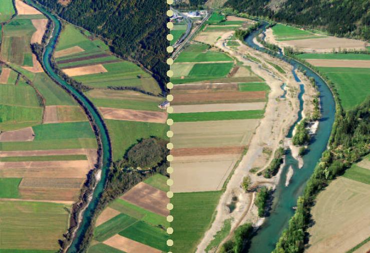
| 22:22, 6 August 2013 | Obergottesfeld before after.JPG (file) |  |
71 KB | Saskia.deltares | Obergottesfeld before and after the construction of the measures. Taken from Life vein – Upper Drau River (2011) | 1 |
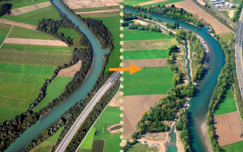
| 22:49, 6 August 2013 | Amlach before after.JPG (file) |  |
84 KB | Saskia.deltares | Amlach/St. Peter before and after construction of the measures. Taken from Life vein – Upper Drau River (2011) | 1 |
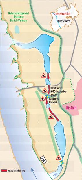
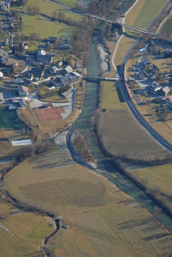
| 09:24, 7 August 2013 | Map bislich.JPG (file) |  |
27 KB | Saskia.deltares | Map of planned measures in Bislich-Vahnum. Taken from NABU-Naturschutzstation e.V., Nebenstromrinne am Niederrhein | 1 |
| 09:26, 7 August 2013 | Faltblatt LIFE-Projekt Nebenrinne Bislich-Vahnum.pdf (file) | 1.46 MB | Saskia.deltares | Brochure of the Bislich-Vahnum project (©NABU-Naturschutzstation e.V.) | 1 | |
| 15:32, 7 August 2013 | RUHRSDORF ROSSATZ poster ruehrsdorf.pdf (file) | 3.09 MB | Saskia.deltares | Map of project site Ruhrsdorf-Rossatz | 1 | |
| 16:12, 14 November 2013 | 3 EU.pdf (file) | 51 KB | Bbelletti | 1 | ||
| 16:13, 14 November 2013 | ScottishMImAS.pdf (file) | 63 KB | Bbelletti | 1 | ||
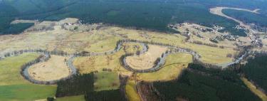
| 17:28, 29 January 2014 | Spree 1.jpg (file) |  |
10 KB | Benjamin Kupilas | Reconnected meander Mönchwinkel II: The former main channel was blocked by a gravel dam (left side at the picture) to redirect all flow through the new meander; the remaining old main stem stretch serves as new flow protected habitat. | 1 |
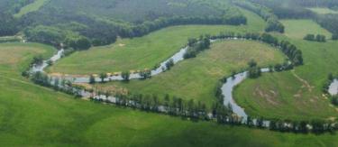
| 17:34, 29 January 2014 | Spree 2.jpg (file) |  |
11 KB | Benjamin Kupilas | Reconnected meander Mönchwinkel I (left meander) and Mönchwinkel II (right meander). | 1 |
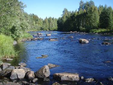
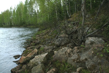
| 17:27, 30 January 2014 | K picture1.jpg (file) |  |
40 KB | Benjamin Kupilas | The restored riffle section Hirvaskoski at River Kuivajoki. Most of the boulders that were removed from the river during channelisation were placed back in early 2000s to create more heterogenous habitat for the stream biota. | 1 |
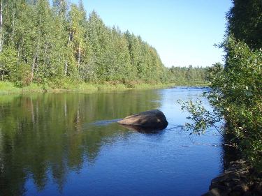
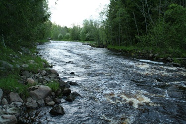
| 17:30, 30 January 2014 | K picture2.jpg (file) |  |
40 KB | Benjamin Kupilas | The non-restored riffles lack heterogenous flow pattern of the natural riffle sections | 1 |
| 17:31, 30 January 2014 | K picture3.jpg (file) |  |
73 KB | Benjamin Kupilas | During channelisation for timber transport boulders were removed from the river channel and placed at the banks where they still remain (photo from non-restored Hirvaskoski 2012). | 1 |
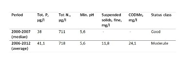
| 17:46, 30 January 2014 | K table1.jpg (file) |  |
10 KB | Benjamin Kupilas | Table 1 | 1 |
| 11:20, 12 February 2014 | V picture1.jpg (file) |  |
72 KB | Benjamin Kupilas | Picture 1. Niskakoski, a restored site at river Vääräjoki | 1 |
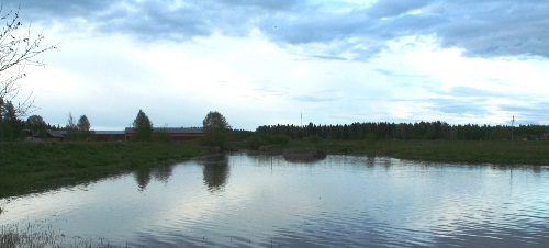
| 11:27, 12 February 2014 | V picture2.jpg (file) |  |
53 KB | Benjamin Kupilas | Picture 2. Vääräjoki: lowland river with agriculture in the catchment area. | 1 |
| 11:33, 12 February 2014 | V table1.jpg (file) | 19 KB | Benjamin Kupilas | 1 | ||
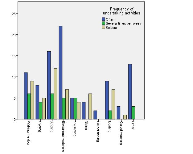
| 11:39, 12 February 2014 | V picture4.jpg (file) |  |
26 KB | Benjamin Kupilas | Figure 2: Frequency of common resident activities near Vääräjoki. | 1 |
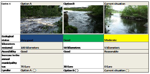
| 11:40, 12 February 2014 | V picture3.png (file) |  |
146 KB | Benjamin Kupilas | Figure 1. One of the eight choice cards used in the questionnaire. | 1 |
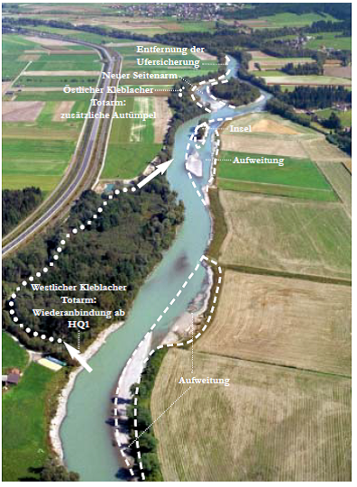
| 13:15, 12 February 2014 | D picture1.png (file) |  |
593 KB | Benjamin Kupilas | Figure 1: Overview restoration measures Kleblach (cp. MANDLER, H., PETUTSCHNIG, W. & SEREINIG, N., 2004) | 1 |
| 13:15, 12 February 2014 | D picture2.png (file) |  |
372 KB | Benjamin Kupilas | Figure 2: morphological development of the side channel (cp. UNTERLERCHER, M. & PETUTSCHNIG, W., 2011) | 1 |
| 14:38, 12 February 2014 | E picture1.jpg (file) |  |
71 KB | Benjamin Kupilas | Figure 1: Overview restoration measures Aich (cp. IHG, 2007) | 1 |
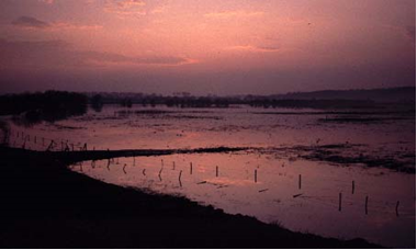
| 07:59, 5 May 2014 | ES floodplain wageningen.png (file) |  |
116 KB | Gertjan | 1 | |
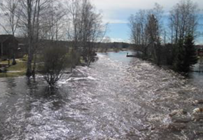
| 08:02, 5 May 2014 | ES springflood Vaarajoki.png (file) |  |
149 KB | Gertjan | Spring flooding in the Vääräjoki (Northern Finland) | 1 |
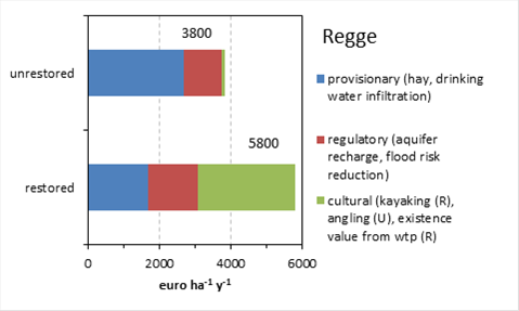
| 08:05, 5 May 2014 | ES Regge economic value.png (file) |  |
24 KB | Gertjan | Total economic value as estimated with the REFORM ecosystem services accumulation approach for the Regge (NL). Data based on thesiswork of Tim Brockhoff. | 1 |
First page |
Previous page |
Next page |
Last page |