Difference between revisions of "Haselünne"
(→References) |
(→Key features of the case study) |
||
| Line 12: | Line 12: | ||
The main objective of the project was to re-connect the channel and the adjacent floodplain area and to re-connect side-channels. The total amount of money available for the project was 10.2 million Euro. | The main objective of the project was to re-connect the channel and the adjacent floodplain area and to re-connect side-channels. The total amount of money available for the project was 10.2 million Euro. | ||
| + | Natural flow dynamics were restored to allow for periodic flooding. About 450 ha of agricultural land in the Hase floodplain were aquired which are now used as grassland or left to natural succession. Summer dikes were removed and side-channels re-connected near Lahre and Lehrte. Maintenance works were reduced to a minimum which had a positive effect especially on beaver populations. | ||
| + | |||
| + | Special attention was given to stakeholder participation (agriculture, water management, nature conservation), to inform the public and to touristic aspects. | ||
==Site description== | ==Site description== | ||
Latest revision as of 11:48, 19 April 2010
Haselünne
Key features of the case study

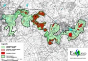
The main objective of the project was to re-connect the channel and the adjacent floodplain area and to re-connect side-channels. The total amount of money available for the project was 10.2 million Euro.
Natural flow dynamics were restored to allow for periodic flooding. About 450 ha of agricultural land in the Hase floodplain were aquired which are now used as grassland or left to natural succession. Summer dikes were removed and side-channels re-connected near Lahre and Lehrte. Maintenance works were reduced to a minimum which had a positive effect especially on beaver populations.
Special attention was given to stakeholder participation (agriculture, water management, nature conservation), to inform the public and to touristic aspects.
Site description
Measures selection
Success criteria
Ecological response
Hydromorphological response
Monitoring before and after implementation of the project
A monitoring of the hydromorphological changes has been carried out by the University of Osnabrück, Department of Biology and Chemistry.
Socio-economic aspects
Contact person within the organization
Extra background information
References