Difference between revisions of "River typology in Romania"
From REFORM wiki
| Line 26: | Line 26: | ||
<tr> | <tr> | ||
<td> Stream in mountain, pied-mont or high plateau area (01+02) | <td> Stream in mountain, pied-mont or high plateau area (01+02) | ||
| − | [] </td> | + | [Image:Type1.jpg] </td> |
<td> RO01 </td> | <td> RO01 </td> | ||
<td> 10 </td> | <td> 10 </td> | ||
Revision as of 08:23, 2 June 2010
Contents
River typology in Romania
General description
XXXXX
Classification system
| Stream type (former symbol) | Code | eco | Catchment size (km2) | Geology | Lithological bed structure | Slope (%0) | Altitude (mdMN) | Precipitation (mm/year) | Temperature (°C) | q (l/s/km2) | q 95% (l/s/km2) | Fish zonnation |
| Stream in mountain, pied-mont or high plateau area (01+02) [Image:Type1.jpg] | RO01 | 10 | 10-1000 | a-siliceous, b-calcareous, c. organic | blocks, boulders, gravel | 20-200 | >500 | 600-1400 | -2 +9 | >5 | >0.5 | Traut, Grayling, Dace |
| Stream sector in pied-mont or high plateau area
Stream sector in pied-mont or high plateau area with endemic species (03) 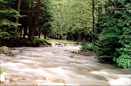 |
RO02 RO02* | 10 | 1000-10000 | a-siliceous, b-calcareous | gravel, boulders | 3-20 | >500 | 600-800 | 7-9 | 5-20 | 1-3 | Grayling, Chub, Romanichthys valsanicola (*) |
| Stream sector in intramountain depression (05) File:Type3.jpg | RO03 | 10 | >10 | a-siliceous, b-calcareous, c-organic | sand, gravel, boulders | 1-3 | >500 | 600-800 | 7-9 | 3-20 | 0.2-2 | Dace, Chub |
| Stream in hilly or plateau area (07+09+014+23) File:Type4.jpg | RO04 | 10a,11,12,16 | 10-1000 | a-siliceous, b-calcareous, c-organic | sand, gravel | 1-30 | 200-500 | 500-700 | 8-10 | 1-5 | 0.01-0.5 | Dace |
Stream sector in hilly and plateau area (04+06+08)
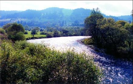 |
RO05 | 10, 10a | 1000-10000 | a-siliceous, b-calcareous, c-organic | sand, gravel | 0.5-20 | 200-500 | 500-700 | 8-10 | 3-15 | 0.2-2 | Chub, Med. Barbel |
| Stream in plain area (10+15+24) File:Type6.jpg | RO06 | 11,12,16 | 10-2000 | a-siliceous, b-calcareous, c-organic | sand, silty clay, silt | <8 | <200 | 400-600 | 9-11 | <3 | <0.3 | Chub, Perch, Carp |
| Stream sector in plain area (11) File:Type7.jpg | RO07 | 11 | 1000-3000 | a-siliceous, b-calcareous, c-organic | Sand, silt, clay | <1 | <200 | 400-500 | 9-11 | 1-3 | 0.2-0.4 | Dace |
| Stream sector in plain area (16) File:Type8.jpg | RO08 | 12 | 1000-5000 | a-siliceous, b-calcareous, c-organic | Sand, silt | 0.5-5 | <200 | 400-600 | 9-11 | 1-3 | 0.2-0.4 | Chub, Perch |
Stream sector with wetlands in plain area (25)
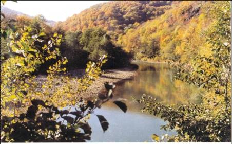 |
RO09 | 16 | 1000-5000 | a-siliceous, b-calcareous, c-organic | Sand, silt | <2 | <200 | 400-600 | 9-11 | 1-3 | 0.2-0.4 | Chub |
| Stream sector in plain area F>3000km2 (11)
F>5000 km2 (12+17+26) File:Type10.jpg |
RO10 RO10* | 11, 12,16 | >3000 >5000 | a-siliceous, b-calcareous, c-organic | Sand, silt, clay | 0.5-5 | <200 | 400-600 | 9-11 | 2-10 | 0.05-1 | Chub, Barbel, Dace |
| Stream sector with wetlands in plain area F>3000km2 (11)
F>5000 km2 (13+18+27) 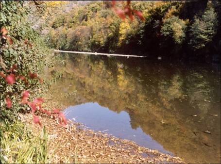 |
RO11 RO11* | 11, 12,16 | >3000 >5000 | a-siliceous, b-calcareous, c-organic | Sand, silt clay | <1 | <200 | 400-600 | 9-11 | 2-10 | 0.1-1 | Barbel, Carp |
| Danube river-Cazane Km 975-863 (RO19) File:Type12.jpg | RO12 | 12 | 570.900-574.850 | Calcareous | sand, gravel, boulders | 0,07 | 100-200 | 600-800 | 8-10 | 9 | 3 | Carp |
| Danube river Cazane-Calarasi Km 863-375.5 (20) File:Type13.jpg | RO13 | 12 | 574.000-698.000 | Siliceous | sand, gravel, boulders | 0,05 | 5-70 | 500-600 | 9-11 | 8 | 2 | Carp* |
| Danube river Calarasi-Isaccea Km 375.5-100 (21) File:Type14.jpg | RO14 | 12 | 698.000-780.650 | Siliceous | sand, clay | 0,04 | 5 | 400-500 | 9-11 | 7 | 1.5 | Carp* |
Isaccea-Sulina (22)
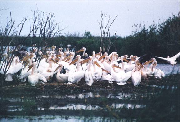 |
RO15 | 12 | 805.300 | Organic | sand, silt | <0,01 | <5 | 400-500 | >11 | Carp, Pontic shad** | ||
| Streams qualitatively influenced by natural causes and temporar waters
Stream influenced from qualitative point of view by natural causes (28) File:Type16.jpg |
RO16 | 10-1000 | ||||||||||
| Temporary stream in mountain area (29) File:Type17.jpg | RO17 | 10-1000 | siliceous | blocks, boulders, gravel | 20-150 | >800 | 700-1100 | -2 +8 | 2-16 | 0 | ||
| Temporary stream in pied-mont or high plateau area(30) File:Type18.jpg | RO18 | 10-1000 | a-siliceous, b-calcareous | boulders, gravel | 25-45 | 500-800 | 600-800 | 7-9 | 5-17 | 0 | ||
| Temporary stream in plateau area (31) File:Type19.jpg | RO19 | 10-1000 | a-siliceous, b-calcareous | gravel, sand, silt | 5-30 | 200-500 | 450-550 | 8-10 | 1.5-7 | 0 | ||
| Temporary stream in plain area (32) File:Type20.jpg | RO20 | 10-2000 | a-siliceous, b-calcareous | sand, silt | <8 | <200 | 400-500 | 9-11 | <2 | 0 |