Difference between revisions of "Stream valleys in the Arnsberger forest (LIFE project)"
(→Site description) |
(→Site description) |
||
| Line 20: | Line 20: | ||
The main streams in the project area are the Heve, Große Schmalenau, Kleine Schmalenau and Hevensbrink, including the adjacent floodplain forests. These are small lower-mountain, gravel-bed streams (Type 5 according to the German stream typology). | The main streams in the project area are the Heve, Große Schmalenau, Kleine Schmalenau and Hevensbrink, including the adjacent floodplain forests. These are small lower-mountain, gravel-bed streams (Type 5 according to the German stream typology). | ||
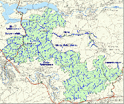
[[Image:pgebiet.gif|thumb|left|Map of project area from http://www.life-bachtaeler.de]] | [[Image:pgebiet.gif|thumb|left|Map of project area from http://www.life-bachtaeler.de]] | ||
| + | |||
| + | <p></p> | ||
==Measures selection== | ==Measures selection== | ||
Revision as of 10:01, 8 April 2010
Stream valleys in the Arnsberger forest (LIFE project)
Key features of the case study
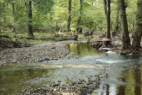
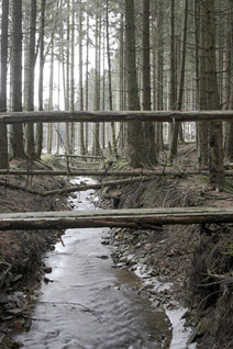
At first glance, the streams in the Arnsberger Wald look quite natural. However, they have been straightened in historical times and much of the floodplain is covered by non-natural spruce forest and natural alder and oak riparian forests are missing along many streams. The objective of the project is to re-connect meanders, to enhance instream habitat and natural channel dynamics e.g. by the placement of large wood, and to restore natural floodplains as well as hydrologic balance e.g. to restore moor forests.
Photos from http://www.life-bachtaeler.de
For more information see: http://www.life-bachtaeler.de (German website)
Site description
The main streams in the project area are the Heve, Große Schmalenau, Kleine Schmalenau and Hevensbrink, including the adjacent floodplain forests. These are small lower-mountain, gravel-bed streams (Type 5 according to the German stream typology).

Measures selection
Success criteria
Ecological response
Hydromorphological response
Monitoring before and after implementation of the project
Socio-economic aspects
Contact person within the organization
Extra background information
References
Related Measures
- Initiate natural channel dynamics to promote natural regeneration
- Introduce large wood
- Reconnect backwaters and wetlands

