Difference between revisions of "File:River characterisation hierarchy of spatial scales.png"
From REFORM wiki
Gjgeerling (Talk | contribs) (Hierarchy of spatial scales for the European Framework, including indicative spatial dimensions and timescales over which these units are likely to persist.) |
(No difference)
|
Latest revision as of 12:39, 9 January 2013
Hierarchy of spatial scales for the European Framework, including indicative spatial dimensions and timescales over which these units are likely to persist.
File history
Click on a date/time to view the file as it appeared at that time.
| Date/Time | Thumbnail | Dimensions | User | Comment | |
|---|---|---|---|---|---|
| current | 12:39, 9 January 2013 | 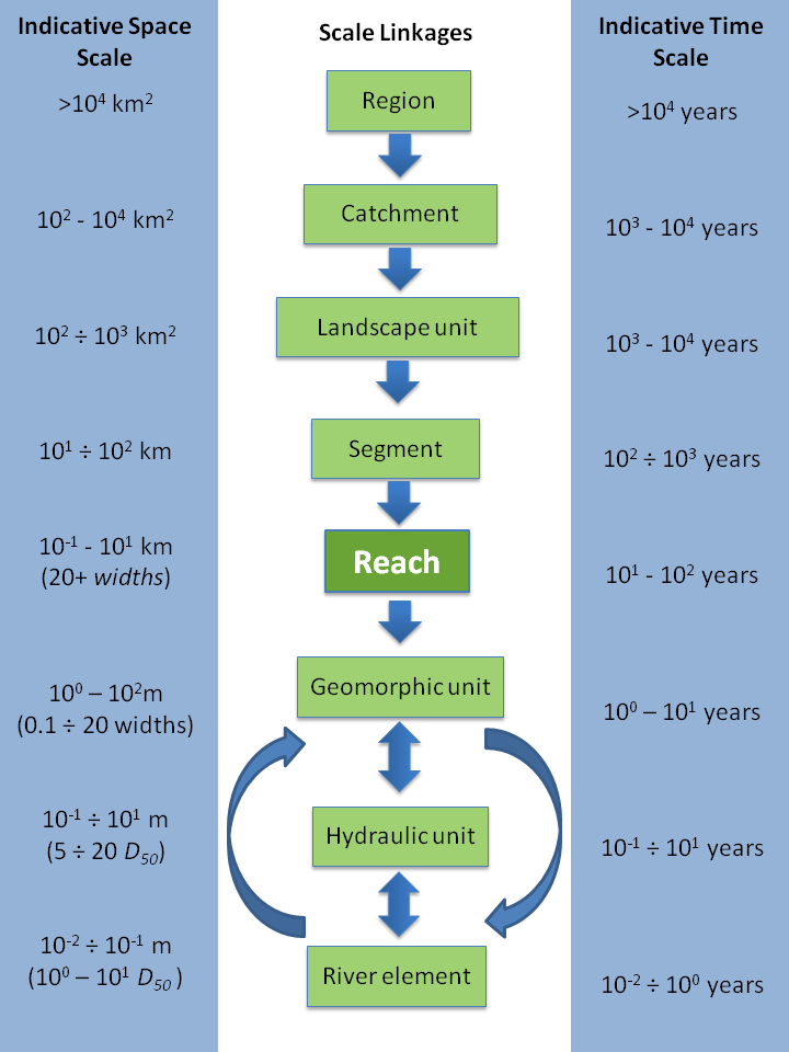 | 720 × 960 (85 KB) | Gjgeerling (Talk | contribs) | Hierarchy of spatial scales for the European Framework, including indicative spatial dimensions and timescales over which these units are likely to persist. |
- You cannot overwrite this file.
File usage
The following page links to this file: