Difference between revisions of "Vallacuera ravine. Removal of a dyke."
(→Extra background information) |
(→Vallacuera ravine. Removal of a dyke.) |
||
| Line 23: | Line 23: | ||
New plantations were increased natural riparian vegetation and eliminated non-native species.<br /> | New plantations were increased natural riparian vegetation and eliminated non-native species.<br /> | ||
| − | The construction of a new pond increases the biodiversity (''Phragmites sp. '', ''Thypa sp. '') and it’s good for the European mink (''Mustela lutreola'') and the European turtle (''Emys orbicularis'') increasing the habitat carrying capacity for both species. | + | The construction of a new pond increases the biodiversity (''Phragmites sp. '', ''Thypa sp. '') and it’s good for the European mink (''Mustela lutreola'') and the European turtle (''Emys orbicularis'') increasing the habitat carrying capacity for both species.<br /> |
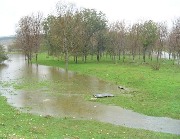
| + | [[Image:Vallacuera_pond.jpg|center|New pond created in the mouth of Vallacuera ravine]] | ||
==Success criteria== | ==Success criteria== | ||
Revision as of 19:57, 19 May 2010
Vallacuera ravine. Removal of a dyke.
Key features of the case study
The dike built in the 80’s after the canalization works carried out in Arga River was removed to recover the natural floodplain in one of the tributaries’ confluence: Vallacuera stream.
The main objective of this project is to restore the river Arga natural floodplain by removing the dyke and increasing the fluvial territory.
There are other secondary objectives: to increase the quality of habitat in Community Interest Areas, with special attention to European mink (Mustela lutreola); creating new habitats for otter (Lutra lutra) and European turtle (Emys orbicularis); quality improvement of habitats 92A0 (willow and black poplar plantation) and 92D0 (tamarisk plantation); spatial planning for cattle.
Site description
The ravine is of great ecological importance since acts as a corridor between the dry steppes located upstream and the fluvial ecosystem. The floodplain restored will be an important transitional area were Mediterranean species dependent on regular floods will develop.
Measures selection
The main measure was the remove of the dike. With the increase of the floodplain, the objective was to reduce the flood risk in Funes, town located downstream that suffered many floods since the canalization of Arga River was carried out in the 80’s.
New plantations were increased natural riparian vegetation and eliminated non-native species.
The construction of a new pond increases the biodiversity (Phragmites sp. , Thypa sp. ) and it’s good for the European mink (Mustela lutreola) and the European turtle (Emys orbicularis) increasing the habitat carrying capacity for both species.
Success criteria
Ecological response
Vegetation
Riverside vegetation has been restored.
Mammal
The quality of habitat for the European mink (Mustela lutreola) was improved.
Other
The quality of habitat for otter (Lutra lutra) and European turtle (Emys orbicularis) was improved too at the same time as the European mink.
Hydromorphological response
Hydrological regime
Unaffected
River continuity
Improved
Morphological conditions
More than 900 metres of dyke have been removed. At least 3,9 has of natural floodplain has been restored for ordinary floods, reducing the flood risk in the downstream town of Funes.
Monitoring before and after implementation of the project
Socio-economic aspects
Project costs
The total costs of the entire project 138.840,25€
Contact person within the organization
Fernando Mendoza, e-mail
Gestión Ambiental Viveros y Repoblaciones de Navarra, S.A.
Padre Adoain, 219 bajo
31015 Pamplona - Navarra
Fax: (00 34) 948 38 23 91
Extra background information
Company’s web page: http://www.gavrn.com
GERVE-LIFE project: http://www.life-gerve.com
INTERREG GIRE project: http://www.interreg-gire.eu
Government of Navarra: http://www.navarra.es
References
http://www.life-gerve.com/eng/portal/index.asp
Related Measures
- Link flood reduction with ecological restoration
- Develop riparian forest
- Remove hard engineering structures that impede lateral connectivity
- Adjust land use to develop riparian vegetation
- Revegetate riparian zones
- Remove bank fixation
- Construct semi-natural/articificial wetlands or aquatic habitats
